Tram Track Tracer
Project type: Transport
Scale: Regional
Tram Track Tracer (TTT) was one of the first projects to adopt the holistic approach described in the sustainability compass (for more information head to http://tramtracktracer.eu). This project shows how the compass can be customised to address a specific problem area. The project consisted of a study to extend Brussels’ tram network into Flanders to find alternatives to the congestion paralysing the Brussels region during peak hours (some of the worst congestion in Europe). The TTT was essentially developed as a decision making tool.
1 / Analysis
Developing new tramlines in Belgium is complicated due to the vast range of stakeholders – a single stakeholder (IE a municipality or community group) has the power or capacity to block such project. Accommodation (or compromise) is therefore essential.
2 / Objectives
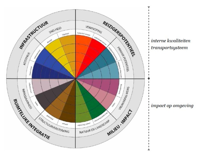
The theory behind the Compass was used to define the scope of the analysis and evaluation. This was synthesised into sixteen main topics which helped to give scope to the project and also to avoid excessive complexity for such a large-scale project. The tool and process needed to be clear and transparent, easy enough to understand for outsiders while able to assess complex problems. The sixteen main topics consist of:
- Costs
- Direct costs
- Indirect costs
- Travel speed
- Punctuality
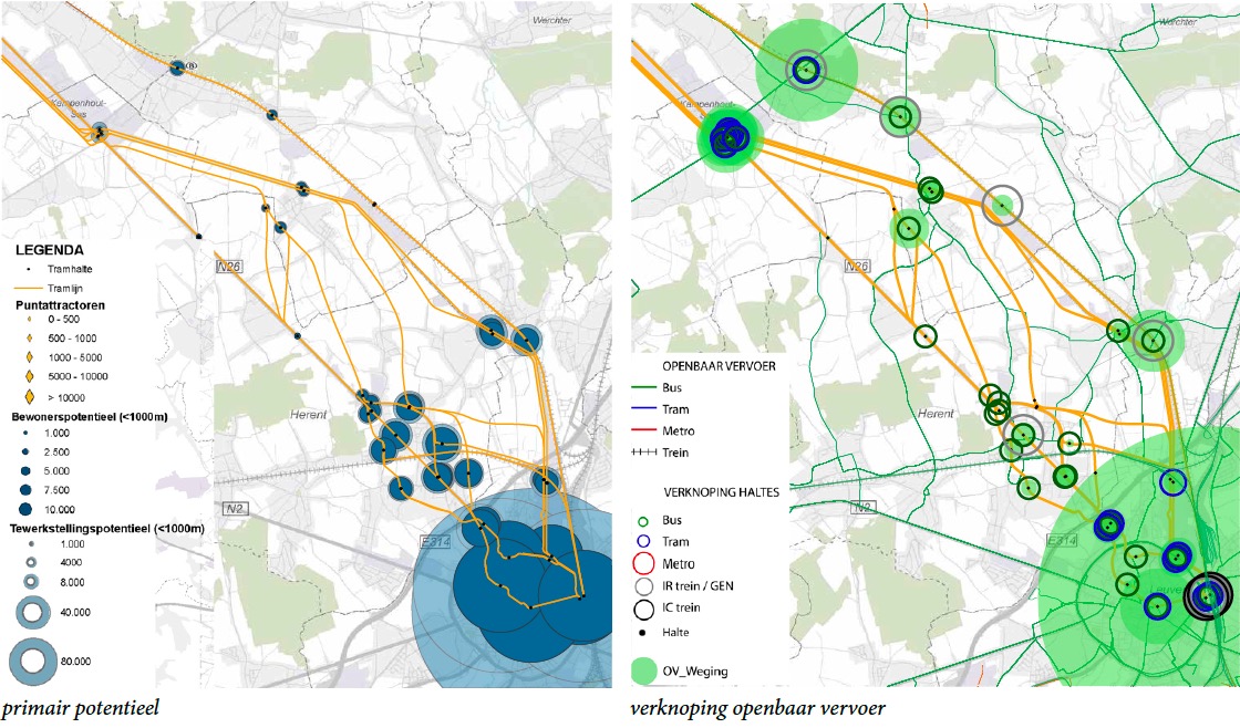
- Travel potential
- Interchange – Collective transport
- Interchange – Individual transport
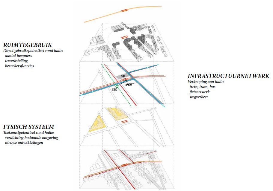
- Connection with housing
- Connection with attractions
- Environmental impact
- Human safety – Relations
- Human safety – Footprint
- Protection of ecosystems
- Protection of landscape
- Spatial integration
- Structuring – Current network
- Structuring – Potential network
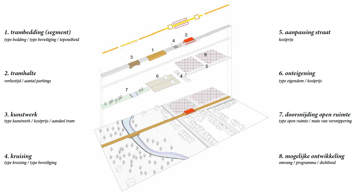
- Fit – Infrastructure
- Fit – Stops
3 / Development
The process followed the typical development cycle, based heavily on research by design. A GIS tool was developed especially for the analysis of the project and communicated with a diagram that synthesised the results. In other words, both the evaluation tool and the communication diagram were customised for the project.
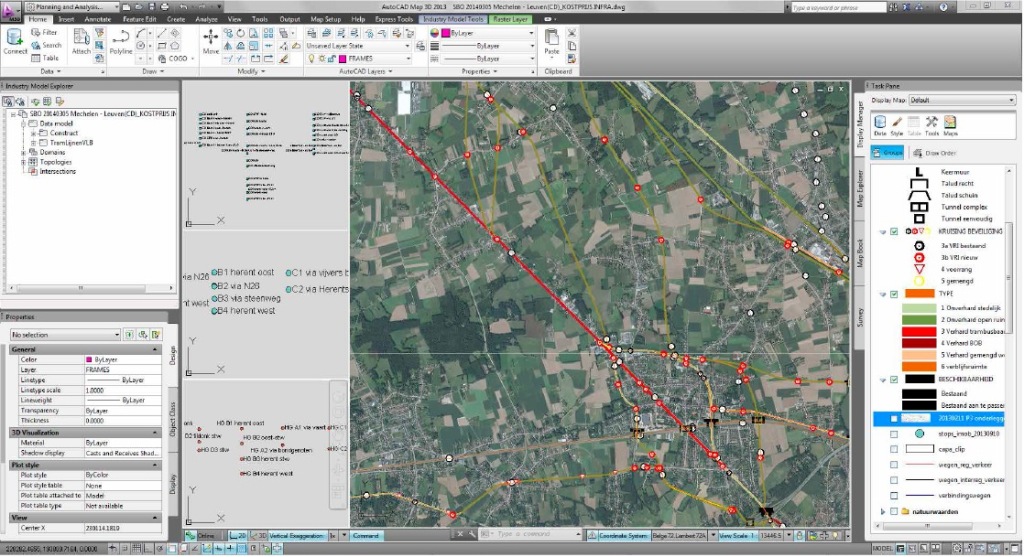
GIS based evaluation tool. An AutoCad Map plug-in was custom made to evaluate speed cost and so on. This allowed lines to be quickly mapped out without having to fully design them and to easily change a small element (such as a stop or a provide an alternative route). All sixteen criteria could be assessed quantitatively and were spatial. In other words, the width of streets, the speed of the lines, the changes in land use, the costs based on existing materials and so on could all be calculated automatically.
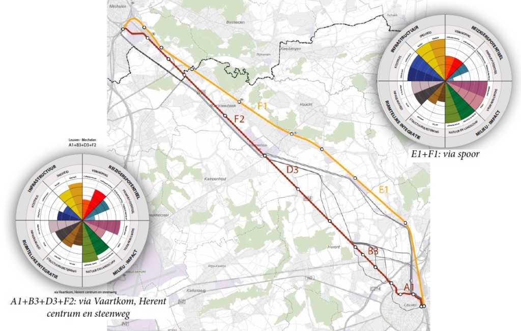
Multi-criteria analysis and communication diagram. The results from the GIS assessment were then summarised into a pie graph focusing on 16 distinct ‘themes’ – no overall score was given. This essentially was a synthesis of a vast number of numbers however it helped to get very quick feedback about the main issues.
Essentially the development cycle involved refining trajectories. Major destinations were identified and then a vast range of segments were plotted. Essentially the segments could be cut and exchanged so it was easy to shift a line from one street to another without having to re-evaluate the entire route. Once the segments were identified, larger lines could be made and each tested. This allowed for a lot of flexibility and provided a good foundation for discussions without assuming a defined route.
4 / Outcome
Eventually over 1000 km of lines were analysed and allowed four main tram routes to be selected. This process ensured that the interests of a vast range of stakeholders could be addressed, transparently and the viable options could be easily discussed, where there was possible conflict.
Assessed section